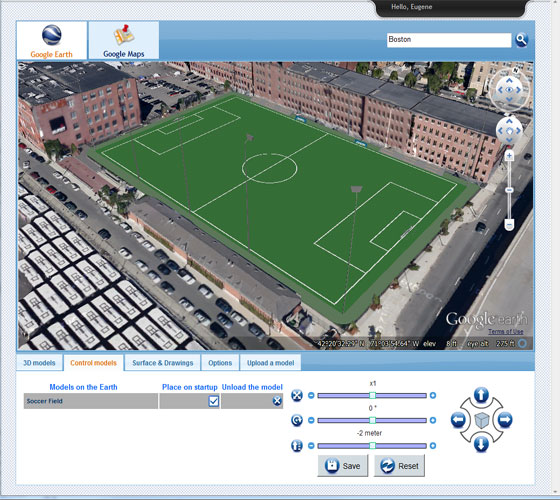
Now, the users can insert the Google Earth site context with Revit. The free CADtoEarth will help them to do it throughout.
The users know that the Revit and BIM designs are generally 'in context' - with the greater accessibility.
Vasari can bring in the Google Earth images into the Revit Model. Revit have some add-ins here 1. Importing surface from Google earth and 2. Uploading building from the same.
Hit this link to get more: apps.exchange.autodesk.com
How to import topography from Google Earth: First of all, Close the Revit, then install the tool from link and then start Revit. Now, click the CADtoEarth Pane button, and use the search box at top of the dialog to discover the site. Now keep zooming it unless the 'Cannot Save' message completely vanished. Here the users have to click the surface tab in the dialogue box and then click on the Save Earth's surface. Now keep the dialogue box open and click the surface button on Revit-add INS. In that mean time, your surface has been connected to revit files. Now you can use the topography tool.
For Heads ups: revitaddons.blogspot.com.au

Image Courtesy: apps.exchange.autodesk.com